6,000 years of sea level variations measured to the centimetre!
A group of researchers studying the architecture of coral reefs in Polynesia – including a team from UNIGE – has succeeded in describing the recent history of the Pacific with great accuracy. The result will help fine-tune predictions about global warming.
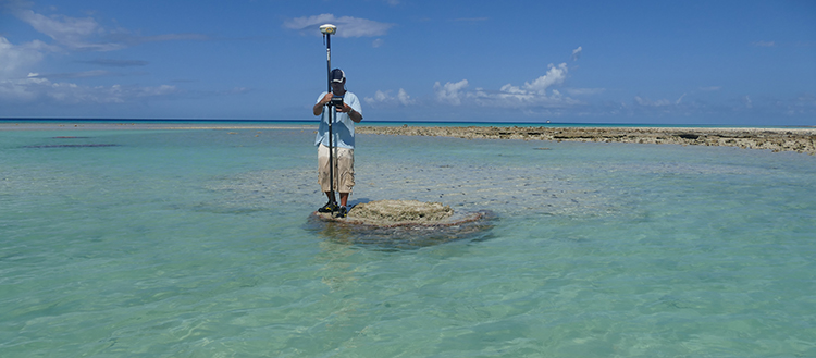
Fieldwork on a microatoll , next to the Makemo Island. (Photo UNIGE/Elias Samankassou )
Geologists are today anticipating a rise in ocean levels of between 80 and 180 centimetres by 2100. But to fine-tune this prediction and upgrade the models underpinning it, we need to know about the recent past in greater detail – on a scale of a few thousand years instead of the millions of years that geologists usually work with. This tour de force was achieved by an international team of researchers that included the University of Geneva (UNIGE). The scientists succeeded in reconstructing the sea-level curve over the last 6,000 years in French Polynesia with unmatched accuracy: to within one centimetre. The research, which is based on analysing coral microatolls, is published in Nature Communications.
Studies based on coral reef growth have always been approximate up to now because corals evolve at depths varying from 0 to 20 metres. Although the existence of these reefs provides evidence about sea level, the information lacks precision. "By concentrating on microatolls – small islands formed by a specific variety of coral, Porites – we managed to improve the accuracy to one centimetre," says Elias Samankassou, a researcher in the Department of Earth Sciences in the UNIGE Faculty of Sciences. During four successive campaigns from 2012 to 2015, the international team studied microatolls ranging from ten centimetres to eight metres in diameter, all scattered across twelve South Pacific islands as far apart as the distance between Amsterdam and Sofia. It then required two years of hard work to process and analyse all the data that was collected.
Several factors explain the unparalleled quality of the measurements taken by the researchers. First, the laboratories at the Helmholtz Centre for Ocean Research in Kiel, Germany, were used to measure the uranium-thorium ratio, making it possible to date the samples collected from the microatolls within a few decades or even a few years. Uranium and thorium degrade at different rates: their age can be deduced by comparing the relative proportions found in the samples with their initial proportions at the time of the coral’s formation.
When coral hugs the surface of the water
The most important factor, however, was knowing the pattern and speed at which this particular type of coral develops. It grows upwards until it reaches the surface of the water before extending horizontally, forming a succession of plateaus that reflect the sea level. By studying the architecture of these growth bands, the sea level at a given moment can be determined with great accuracy, together with the variations that have impacted on it over time. This newly available data will help modelling experts narrow the range of their estimates by refining the algorithms on which they are based.
The Polynesian study offers a perfect illustration of the phenomena of the melting ice caps. "First of all, you see a flow of water from the poles to the equator," explains Samankassou. "The drop in pressure exerted by the ice then causes the earth’s crust to rise, which produces a new flow. Last of all, we see the reflux phenomenon from the equator to the poles until the system comes to a new equilibrium."
The study shows that the sea level in Tahiti has risen steadily over the last six millennia, reaching a peak of over 90 centimetres about 4,000 years ago before falling back to its current level. This curve demonstrates the melting of the icecap and the probable breaking off of a section of the pack ice, whose volume it will be possible to estimate using the measurements that were taken. Once again, knowledge of the past will help elucidate estimates for the coming century.
Inequalities in the face of rising water levels
The scientists also point out that changes in sea level did not affect all the islands in the study in the same way. The differences are due to the forces expressed in the earth's mantle, which push some of the islands upwards by means of a resurgence phenomenon, while others are not impacted. "This mechanism was already known," states Gilbert Camoin, CNRS research director at CEREGE (European Centre for Research and Teaching in Environmental Geoscience) in Aix-en-Provence, "but we were able to confirm it with great precision." The practical consequence is unmistakable: not all points on the globe are equal – in the face of rising sea level, Marseille and Athens will probably not be affected in the same way.
18 Jan 2018