[1000] GeoHealth
GeoHealth is about geospatial approaches applied to health. Broadly defined, GeoHealth seeks to understand the relationships between people, location, time and health. The GeoHealth research group is dedicated to research and development in Global Health using advanced geospatial modelling, Geographic Information Systems (GIS), Spatial Data Infrastructures, and spatial statistics. We collaborate extensively with the Institute for Environmental Sciences, several of our research lines are at the interface between Environmental Sciences and Health. In collaboration with WHO and the Health GeoLab Collaborative, we have developed and are maintaining the modelling software AccessMod, an open-source geospatial tool used in many low- and middle-income countries to model the physical accessibility of networks of health services. We are working closely with UNFPA, The Global Fund, WHO/HeRAMS, UNICEF and FIND to develop innovative methodologies to tackle many challenges linked to accessibility, universal health coverage, and resource allocation efficiency.
CURRENT PROJECTS
ACCESSMOD
AccessMod is both a "global" project (co-directed by Prof.. Nicolas Ray and Dr. Steeve Ebener), and a geospatial modelling tool.
The AccessMod project seeks to help health practitioners and Ministries of health (and their partners) worldwide to develop and apply innovative strategies with geospatial data and tools to (1) better understand the status of their health services, and (2) to optimize the planning of future services. The GeoHealth unit at UNIGE focuses on the needs of the African countries, while the Health Geolab Collaborative concentrates on Asian countries.
The tool AccessMod (version 5) is a free and open-source standalone software to model how physically accessible existing health services are to the target population, to estimate the part of the target population that would not receive care despite being physically accessible due to shortage of capacity in these services (human or equipment), to measure referral times and distances between health facilities, and to identify where to place new health facilities to increase population coverage through the scaling up analysis. AccessMod is officially a World Health Organization (WHO) tool. See AccessMod Publication section for links to relevant AccessMod publications.
One Health approach to snakebite envenoming (SNAKE-BYTE)
Swiss National Science Foundation (SNF) project "Tackling the second deadliest Neglected Tropical Disease: predicting and reducing the impact of Snakebite on human and animal health through interdisciplinary analyses of hotspots and access to care (SNAKE-BYTE project)". Project duration: 2018-2022. The Snake-Byte project is a collaboration between the GeoHealth group and the One Health Unit at the Institute of Global Health of UNIGE, the Institute for Environmental Sciences, and the Department of Community Health & Medicine of the Geneva University Hospitals.
With an international team of experts in tropical medicine and public health, animal health, ecology and environmental sciences, herpetology, and spatial analysis, the project will answer the following questions: what is the direct impact of snakebite in human populations living in rural areas of Nepal and Cameroun? What are indirect impacts through an impact on livestock animals and livelihood? Where are the areas/populations at highest risk of snakebite? What is the current geographic accessibility to snakebite lifesaving treatments (i.e. antivenom, ventilator support) in these two countries, and how can we improve it? What are the habitat and distribution of venomous snakes? What could be the consequences of future environmental and population changes on the severity of the snakebite crisis in Cameroon and Nepal?
Results of this project have been presented so far in 15 peer-reviewed publications.
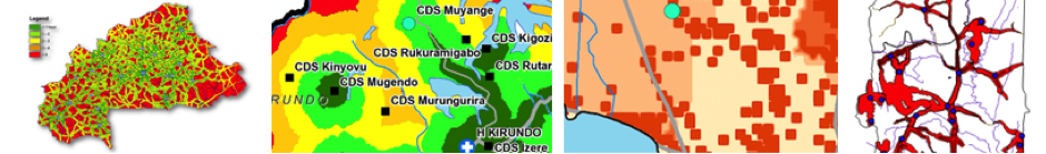
Optimizing networks of Emergency Obstetric and Neonatal Care (EmONC) facilities in Sub-Saharan Africa
The United Nations Population Fund (UNFPA) is collaborating with the GeoHealth group since 2016 to develop new methodologies based on geospatial data and physical accessibility modelling in support to maternal health services. The group uses AccessMod and other geospatial approaches to help Ministries of Health optimize and better plan their facility network, so that more women can have timely access to emergency care. This directly participates to the reduction of maternal mortality care, (SDG target 3.1). Capacity building of GIS groups in countries is also at the core of our work. Engagement countries: Benin, Burundi, Burkina-Faso, Chad, Côte d'Ivoire, Democratic Republic of Congo, Guinea-Conakry, Indonesia, Madagascar, Mali, Mauritania, Mozambique, Rep. of Congo, Rwanda, Senegal, Sudan, and Togo.
Improving resource allocation efficiency through geospatial analyses
The Global Fund to fight AIDS, Tuberculosis and Malaria is collaborating with the GeoHealth group since 2018 to develop methodologies to strengthen allocative efficiency and impact assessment of their three disease programs through geospatial modelling and advanced cartography. Engagement countries: Burkina Faso, Burundi, Central African Republic, Cote d'Ivoire, Chad, Democratic Republic of Congo, eSwatini, Guinea-Conakry, Lesotho, Mali, Nepal, Niger, Sierra Leone, Madagascar.
Diagnostic network optimization (DNO)
FIND is collaborating with the GeoHealth group since 2021 to model DNO in several countries, improve DNO by adding realistic accessibility modelling, and build capacity of countries to use OptiDX. Engagement countries: Cote d'Ivoire, Malawi, Kenya.
Access to health services in emergencies and fragile contexts
WHO/HeRAMS (Health Resources and Services Availability Monitoring System) is collaborating with the GeoHealth group since 2022 to conceptualize, develop, document, and transfer geospatial models of health services accessibility based on HeRAMS to support decision making in countries with emergencies and fragile contexts. Engagement countries: Afghanistan, Central African Republic, Mali, Ukraine, Yemen.
Effects of natural disasters and climate changes on access to health services
We are modeling how natural disasters and climate changes have impacted or will impact access to health and the quality of care in health facilities. From 2018 to 2021, the GeoHealth group engaged with the United Nations Children's Fund (UNICEF) to analyse the loss of timely access to health care after cyclone Idai hit Mozambique in 2019 (which won the Silver award for Best of UNICEF Research 2021).
In 2022, in collaboration with UNFPA-Sudan team and UNFPA Headquarter, we devised a water security index to better understand how climate would affect access to drinking water within the network of maternities in Sudan. A 6-min video describing this challenge is available here.